Mission 66

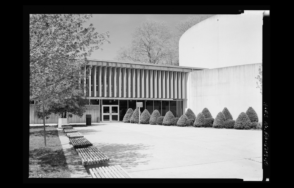
Clingman's Tower Great Smokies National Park - Photo from the Library of Congress

Clingman's Tower Great Smokies National Park - Photo from the Library of Congress

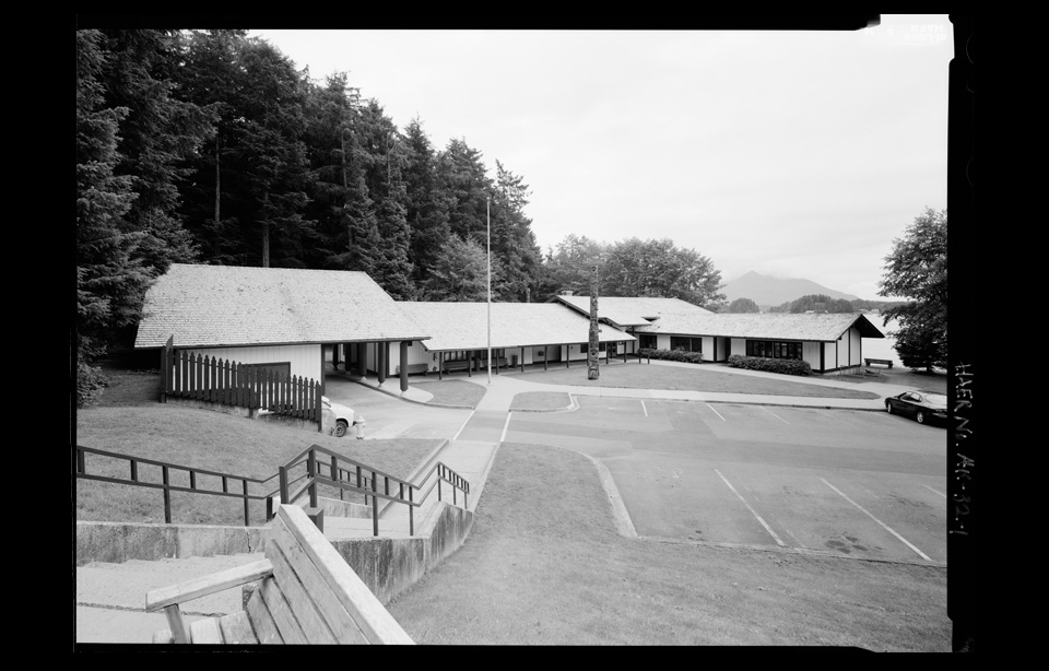
It was impossible to predict the post war motoring boom that swept across the USA in the 1950s. The US Highway System had opened up the country and the introduction of inexpensive automobiles gave an optimistic, wealthy, America an invitation to hit the road. When they arrived at the National Parks what they found were run down tourist centers built by the Civilian Conservation Corps some 20 years earlier, the deteriorating system was stretched to breaking point and the parks were under threat. The government stepped in and set about radically developing the Parks system with an ambitious ten year plan.

MISSION 66 is a forward-looking program for the National Park System intended to so develop and staff these priceless possessions of the American people as to permit their wisest possible use; maximum enjoyment for those who use them; and maximum protection of the scenic, scientific, wilderness, and historic resources that give them distinction
— What is Mission 66?

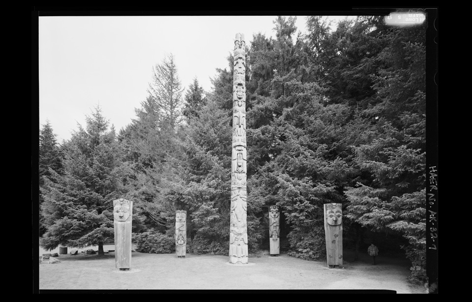
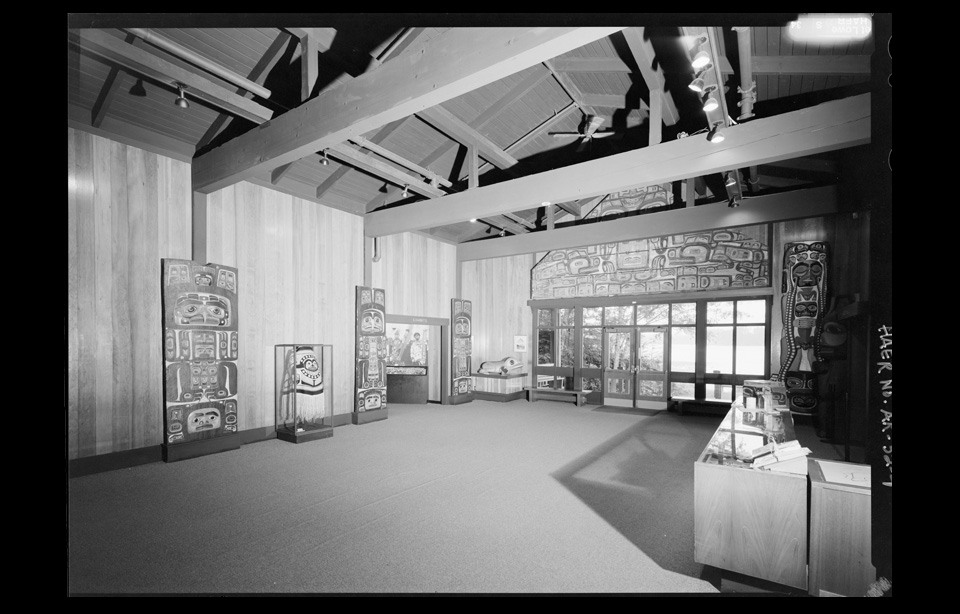
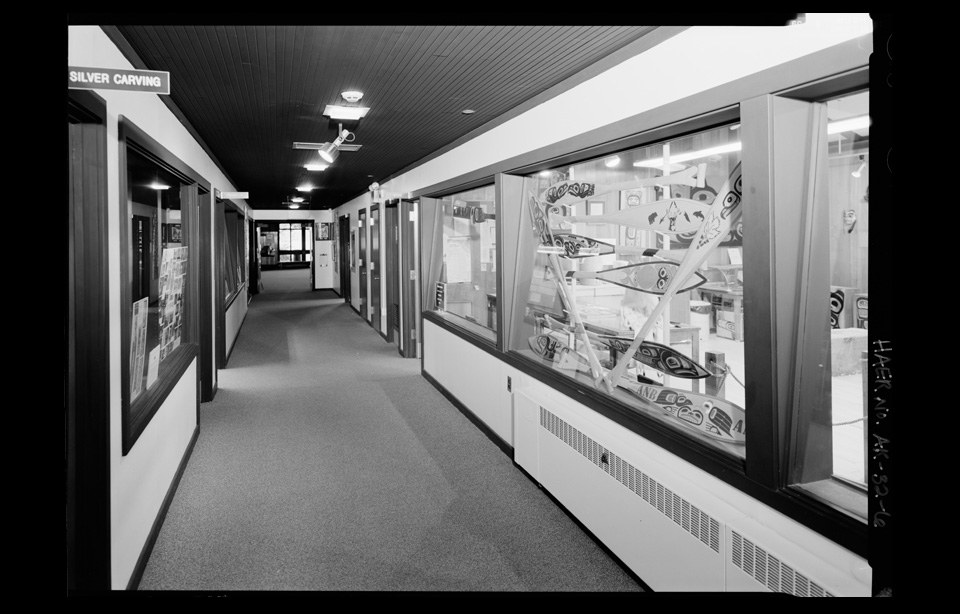
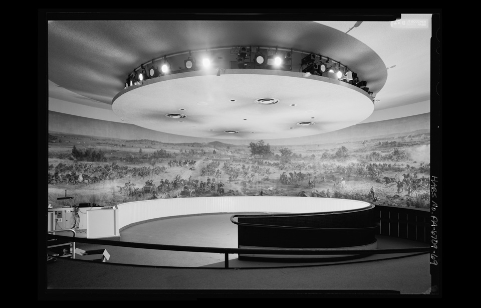
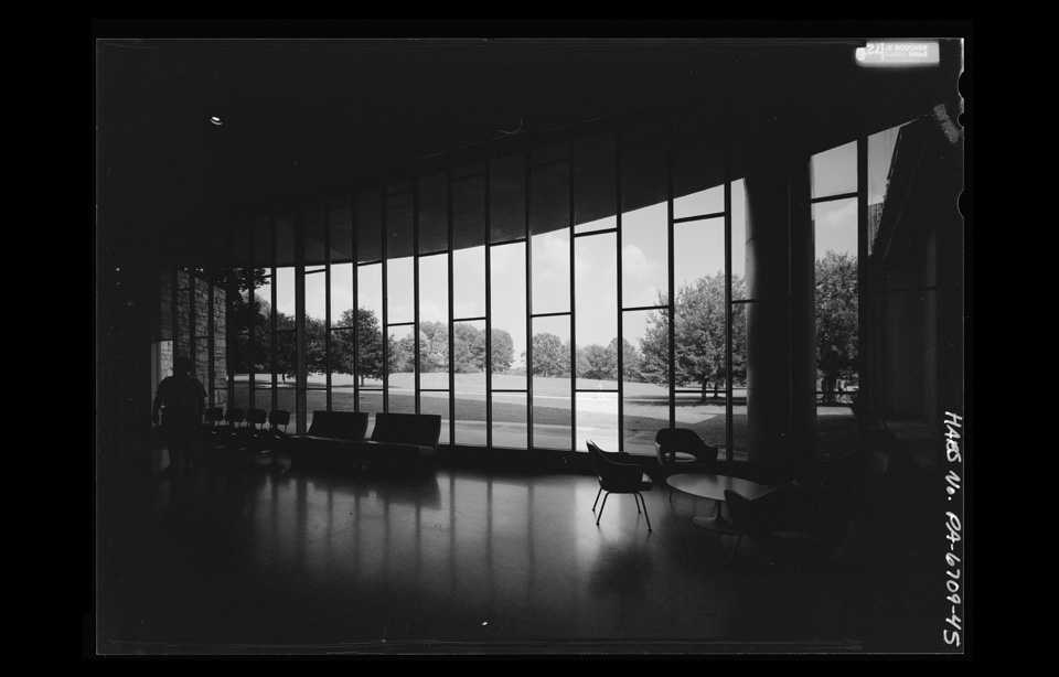
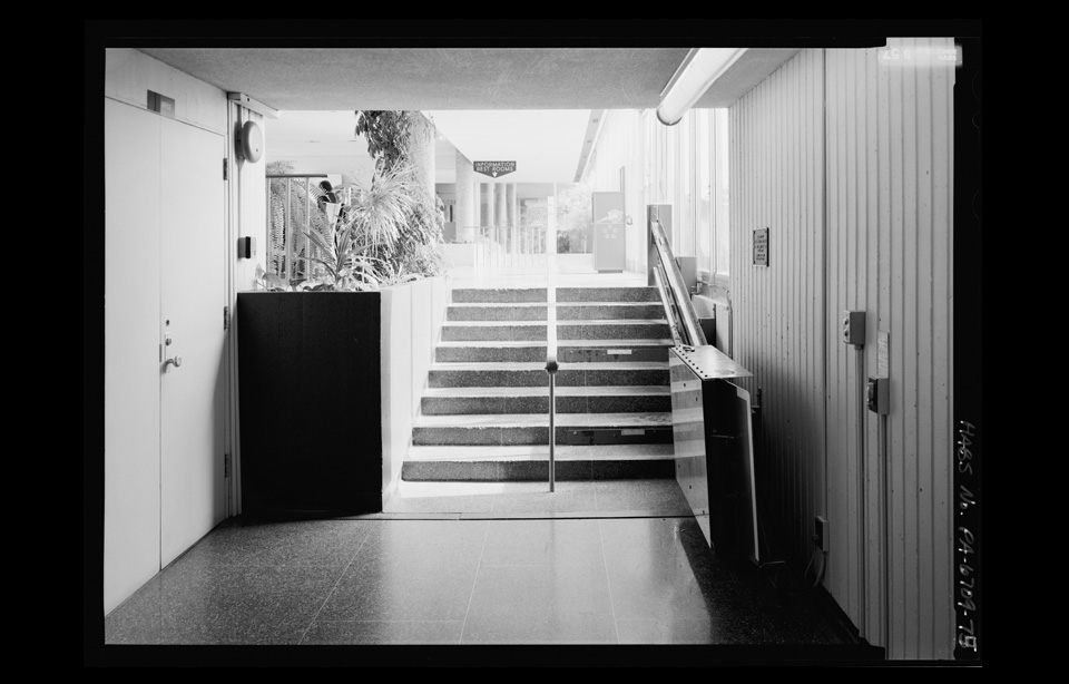
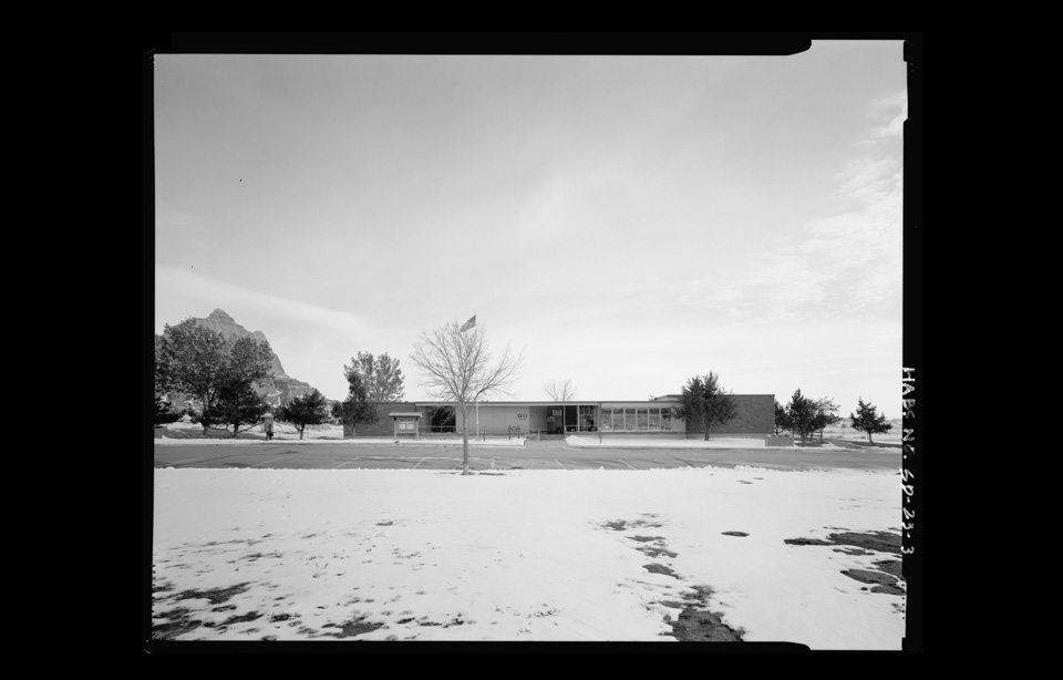
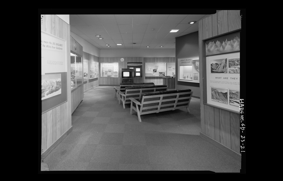
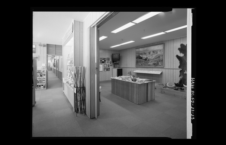
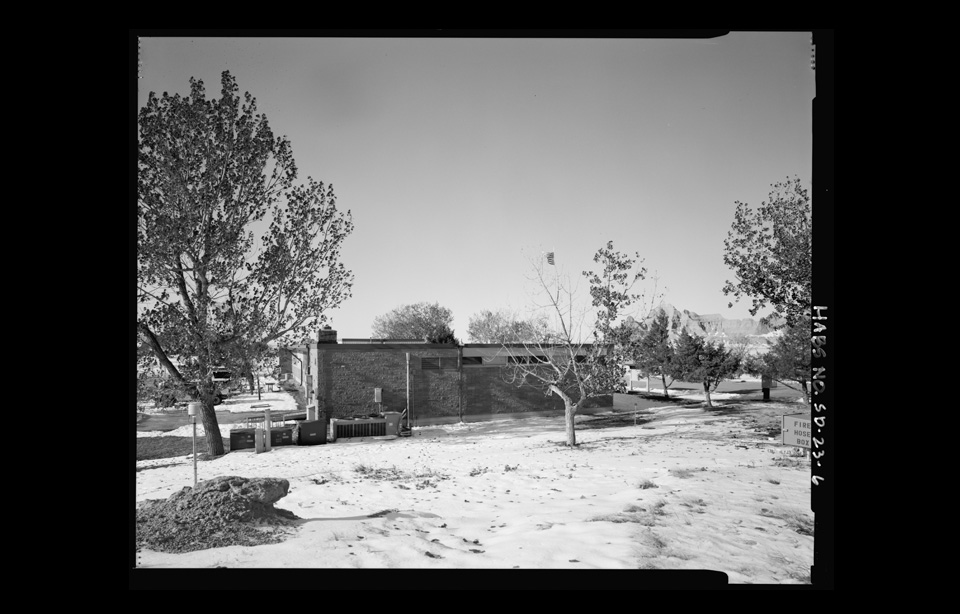
While there were a great many infrastructure developments, the most visible and interactive were the visitors centers. In contrast to the original Civilian Conservation Corps' rustic architecture the new buildings managed to be both bold, contemporary and visible while complementing their surroundings. They became the public face of America's National Parks. In just 10 years more than 100 new visitors centers were open to the public.

Now more than 50 years later the national parks are at a cross roads. A lack of routine maintenance, overuse and a change in attitude amongst visitors is threatening the remaining Mission 66 centers. The architecture style has fallen out of favor and the 'preserve or demolish' stalemate means buildings continue to deteriorate. It now seems that history is repeating itself, when people go to the parks now, what they find are run down, dated visitors centers and an infrastructure which is reaching breaking point. Once again the parks are in danger of being "loved to death." 

What strikes me most about Mission 66 is that it represents a large scale celebration of America's national parks, they had a plan and went through with it. It fell in line perfectly with the National Park Services' original mission "to make the parks accessible to all and to preserve them for future generations."  I find it really hard to put a stake in the ground as to wether I am for or against the preservation of the Mission 66 architecture.  I think, for me, the demolition represents the close of an optimistic, forward thinking chapter in National Parks history from a time when things could get done, my concern is whether another brighter, more celebrated chapter awaits on the next page. I hope it does.

For more information about Mission 66 please visit C. Madrid French's incredibly informative site mission66.com, much of imagery within this post was sourced from Library Of Congress.
Posted on June 4, 2012 and filed under History.

Ordnance Survey Maps

Ordnance Survey Maps

Ordnance Survey Maps

The greatest pleasure in life is opening an Ordnance Survey map
— Bill Bryson

It was only when I started hiking outside of the UK that I realized how fortunate I was having grown up with Ordnance Survey maps. I always loved the beautiful design, the colours and the impeccable detail but I never appreciated what amazing maps they are.

Ordnance Survey is the official map making body of the United Kingdom. Interestingly enough its roots began in 1747 when Lieutenant-Colonel David Watson proposed to King George II a survey of the Highlands, as a means of controlling the Scottish clans after the Jacobite risings in 1745. Watson was assisted by William Roy, Paul Sandby, and John Manson, and their labours culminated in 'The Duke of Cumberland's Map' (I have also seen this referred to as 'The Roy Military Survey of Scotland' or 'The Great Map') which is now held the British Library. Roy in particular had an incredible affinity for surveying, he commissioned the Ramsden Theodolite and  instigated the Principal Triangulation of Great Britain (1783 – 1853) this led to the creation of the Ordnance Survey and in turn the ongoing mapping of the United Kingdom.

The Great Map

The Great Map

What I love most about these maps is the details they hold. The potential for adventure told through their contour lines, village plans and coastal trails. Opening an OS map is like opening a story book; this village has three pubs, a church with a spire and a park bench; I can take this trail over this field, cross these three streams and after the slog up this hill I know I'll get to look across this valley. Its magic.

Overland Track

Overland Track

I really struggled in Australia with some of their maps, I was never in danger of getting lost but they just lacked the detail I was used to. I understand Australia is on a bigger scale than most countries, it has fewer people and less funding for mapping, but I was a little upset when the best map I could find of the Overland Track in Tasmania was 1:100,000 scale. Perhaps I have become a map snob. Lets see what America has to offer. So far the maps have been great, but I'm not sure they will ever have the same place in my heart as the Ordnance Survey maps.

I owe a big thanks to Neil F. King. He tipped me off to the National Library of Scotland who have published a great collection of old Ordnance Survey maps available to view (free) online, they are well worth checking out.

Posted on May 12, 2012 and filed under Classic Kit.

Tea Chronicles Pt.6 - Billy Tea

Mt. French, Frog Buttress, climbers' camp - 1973

Mt. French, Frog Buttress, climbers' camp - 1973

Billy tea is a legendary Australian outback brew favored by bushmen. Ted Cais who contributed some of his vintage bushwalking and climbing photography has also been kind enough to pen some of his early memories of billy tea.

The “Smoke-O” was a staple of outback life around Kajabbi station where I spent my childhood years and never was a finer tea prepared than on an open bush fire.

First, you converted a used jam tin into a billy by threading fencing-wire through holes punched near the top for a handle. The water had to be from a local creek or billabong already steeped in subtle flavours from extracts of plants and wildlife.

Gum trees were plentiful and provided excellent firewood that would be roaring in no time at all. The blackened billy was suspended in the flames without a lid so the water would absorb sparks and ashes whilst coming to a roiling boil. Green eucalyptus leaves were essential on the fire for smoke and distilled oils to imparted a heady signature smoky flavor and complexity.

Brands like “Billy Tea” or “Ty.Phoo Tea” were common in the era and came in coarse leaf form to be measured by eye in a cupped hand and added the instant the boiling water was removed from the fire. Then the billy would be given a few raps with a stick to disperse the leaves and allowed to stew for five minutes or so to achieve a bitter potency saturated with tannins.

The final touch was to swing the billy around your head so centrifugal force would settle the leaves, after which the tea could be decanted into a chipped enamel pannikin. Some might add sugar or even a touch of sweetened condensed milk but the tea was best straight and scalding.

The bushmen would squat around the fire sipping this divine tea while rolling a smoke in Zig-Zag (or Tally-Ho) papers from ready-rubbed flake tobacco with their free hand. A glowing coal from the fire provided the best light so as not to spoil the cigarette with sulphur fumes from a match.

The only tea to compete in aroma is Lapsang Souchong but its flavour is always lacking compared to the classic bush cuppa described above.
— Ted Cais

A huge thanks, as ever, to Ted. You can see all of his photography here.

Posted on May 6, 2012 and filed under Tea.

VHD Poster Pt. 1

VHD Poster#1 - Storm Lantern

VHD Poster#1 - Storm Lantern

The first VHD poster idea. My intent is to produce a range featuring my absolute all time favorite pieces of hiking gear. Look out for Trangia burner and Swiss Army Knife  among others.

Would love any feedback; loving, hating, not interested? Please feel free to share and pass on, I'd love to get peoples reactions.

Update: The posters have arrived and are available for purchase here

Posted on April 29, 2012 and filed under Classic Kit, VHD.

Gear List - Pedestrian Camper - Thomas Hiram Holding

Pedestrian Campers

Pedestrian Campers

I have already raved about the magnificent "Campers Handbook" by Thomas Hiram Holding, it is an amazing time capsule of outdoor knowledge. Written in 1908, Hiram was a pioneer of outdoor recreation. While the main focus of the book is on boat and bike travel there is a section on what he calls "pedestrian camping."

Pedestrian Camping is indeed a delightful past time to those who can walk and love it.
— Thomas Hiram Holding - Campers Handbook, 1908

His kit for two people is as follow.

Here, then is a list of articles, with their weights, for two people:–

One tent 2lbs Set of two tent poles 1lb Set of pegs (ordinary skewers) 1lb Oil Stove–”Baby Primus” 1lb 3oz Aluminium pans–”So-Soon” 1lb 1oz Two aluminium cups and saucers (plates) 4oz Two aluminium knife, fork and spoon sets 4oz Candlestick and candle 2oz Aluminium box of soap 1oz

The half of this is carried by one hence this must be divided by two, giving 3lbs. 2-oz.

Share of baggage 3lbs 2oz Makintosh 1lb 6oz Air pillow 3oz Down pillow (a luxury) 1oz Sweater 1lb Sleeping stockings (long ones) 6oz Extra walking socks 4oz Down Quilt 1lb 10oz Thin Extra Vest 5oz Scarf 2oz Tooth brush, etc., etc. 3oz Hold-all, with straps (under) 8oz

In addition to this 9lbs, 2oz, there is a towel and also some food, as we always like to keep a small supply. The weight is, I believe, less than that of a military rifle alone. One more word on clothing. Wear a big pair of boots and thick socks, nothing loose around the ankles, and nothing tight anywhere.
— Thomas Hiram Holding - Campers Handbook, 1908

A base weight of under 10lbs puts this list firmly in the ultralight category.

Posted on April 24, 2012 and filed under Gear List.

Walking On Hallowed Ground

First AT Blaze

First AT Blaze

This weekend Mrs VHD and I headed to the Maine woods for a few days in the wilderness. Our weekend residence was a cabin nestled in the mountains near Andover, surrounded by trees, mountains, miles of hiking trails and little else. This was it, my first chance to get on the Appalachian Trail. For more than ten years I've read stacks of books about it; everything from AWOL On The Appalachian Trail, Walking The Appalachian Trail and Walking With Spring to Long Distance Hiking–Lessons From The Appalachian Trail and A Walk In The Woods to name a few. I was ready.

Cabin

Cabin

We approached the trail from Sawyer's Notch and there it was, my first white blaze. From where I was standing if I went north I would head deeper into Maine and eventually reach Mount Katahdin (which is no mean feat), if I headed south I could walk all the way to Springer Mountain in Georgia. Amazing.

We chose to head south up to Hall Mountain lean-to. I had butterflies as we headed up the steep rise following a tumbling stream. It looked as if we were the first people to get up there for some time–the previous register entry was from November 2011 and there was no sign of any other human footprints. There was still a decent amount of snow on the mountain, all of it undisturbed. We had lunch at the lean-to and poked around a bit, reading the funny entries in the register and relaxing before we headed back down.

It sounds strange but it was a weird feeling being on the trail for the first time, walking where the likes of Myron Avery, Earl Shaffer and Grandma Gatewood (amongst thousands of others) have previously trodden. I dearly look forward to seeing more of the trail.

To those who would see the Maine wilderness, tramp day by day through a succession of ever delightful forest, past lake and stream, and over mountains, we would say: Follow the Appalachian Trail across Maine. It cannot be followed on horse or awheel. Remote for detachment, narrow for chosen company, winding for leisure, lonely for contemplation, it beckons not merely north and south but upward to the body, mind and soul of man.
— Myron Avery, In the Maine Woods, 1934
Posted on April 18, 2012 and filed under Quote, VHD.

Hugh Glass

Hugh Glass

Hugh Glass

The last thing in life one wants to do is scare a bear with cubs. Worse still a grizzly bear, when alone, in a remote and hostile part of South Dakota. When the bear charges there is little left to do but rollover, play dead and await your fate. Well, unless your name is Hugh Glass.

Glass was a trapper in the 1800's and was attacked while scouting game for his expedition in Grand-River (presently Perkins Country). The story goes that before Glass could fire his rifle the bear was upon him, he drew his knife and fought the animal as it clawed him, ripping at his flesh and shredding his body.

Two fellow trappers ran to his aid and finished off the bear before attending to the mortally wounded Glass. When the expedition leader Andrew Henry arrived he found Glass unconscious. He had been ripped apart, had a broken leg, and gashes so deep that his ribs were exposed. There was no doubt he was a goner. Andrews asked for men to stay with Glass as he passed, and to give him a proper burial. Thomas Fitzpatrick and Jim Bridger volunteered to stay with him and bury the done-for mountain man when the time came. According to the men, after waiting some days they were disturbed by hostile Indians; panicking they grabbed Glass' rifle and equipment and ran for their lives. Glass was alone.

He lay there unconscious but not yet dead. After some time he began to stir and eventually regained consciousness. He was 200 miles from the nearest settlement of Fort Kiowa on the Missouri River. Furious at being left, the thought of revenge spurred him into action and he began his long crawl into American folklore. He set his own leg and tied his bearskin shroud around his exposed wounds. He lay across rotten logs to allow maggots to eat the dead flesh from his injuries, thus preventing them from going gangrenous. Fearing hostile natives he journeyed inland, crawling for six weeks, and surviving on berries, roots and scraps of meat stolen from startled wolves.

With aid from friendly natives and the help of a crude raft he built himself, Glass made it to Fort Kiowa alive and began his long recuperation. He eventually tracked down Fitzpatrick and Bridger but spared both their lives. He did however, reclaim his rifle and returned to the wilderness as a trapper and fur trader. Glass died in the winter of 1833 on the Yellowstone River during an attack by the Arikara.

This is just an incredible story! There has been so much written about this man in the form of both fact and fiction, and it is hard to separate the truth from the legend. Either way this is a great tale of pioneering America and legends they bore. There is now a monument to Glass at the site of the bear attack on the southern shore of Shadehill Reservoir, on the forks of the Grand River. If you ever get chance to visit doff your cap to Old Glass for me.

Posted on April 13, 2012 and filed under Hero.