I'm a little embarrassed it has taken me this long to quote Walt Whitman, this is an excerpt is from "Song of the open Road" self published in Leaves of Grass, 1855. What an opening, it perfectly captures the giddy expectations and desires one gets when embarking on a grand journey. Enjoy.
Tips from the Archive #003
A great tip from Dennis Look's "Joy of Backpacking," this is a superb book written in 1976. Look is a passionate writer he cares deeply about the wilderness and everything in this book puts the environment first. The book is still as relevant as it was in the 70's.
Tip 003 – Your Parka Works as a Day Pack.
Harvey Manning's 1972 Gear List
It doesn't get better than this. From "Backpacking One Step at a Time" one of the all-time great hiking book, written by one one of the all-time great hikers.
Parks Canada Logo
I think that the Parks Canada logo has just taken the lead as my favourite logo design used by a government body. This charming mark was designed in the 1970's by Roderick Huggins the cute little fellow has been stealing the hearts of visitors ever since.
I came across the newer version when I recently visited Fundy National park. It might not have authority, the stopping power, or official look of a government body but I think it sets a simple and innocent tone, I imagine kids love this logo and anything that engages young generations in the outdoors is a winner for me.
Damper
Damper is an iconic Australian bush bread - a staple for stockmen, swagmen, drovers and indigenous Australians alike. It is similar to bannock but is traditionally cooked directly on campfire coals or in a Dutch oven. The recipe is simply water and self raising flour, but everyone seems to have their own unique spin. The recipe I followed is from Viv Moon's incredible "Outdoor Cookbook"
This was very simple and very tasty, I followed Viv's recipe to the note. I used a trivet in my oven just to lift the bread a little and get the heat circulating. As ever with a Dutch oven it took a while to get the really good coals ready but it can't be rushed. I preheated the oven and dropped the dough in, checking after 20 minutes - the bread had risen nicely and giving it a tap I got the tell-tale hollow sound. I added more coals and increased the heat to try and get a little more colour and gave it another ten minutes.
The results were great. It seemed to rise more than bannock but didn't quite get the colour of the skillet bread. Taste wise it was light, fluffy and delicious. We ate it with campfire chilli and had enough left for breakfast the next day. I will definitely be making this again.
Head to head against bannock I preferred damper; although it tasted similar it was a much lighter bread. It does however take longer to cook and requires a camp oven not just a frying pan or skillet.
If any body else has tried damper or has their own spin on it I'd love to hear about it.
VHD Poster Pt. 3
The third VHD poster. Please feel free to share, pass on, pin, tweet whatever you think. Would love any feedback.
Update: The posters have arrived and are available for purchase here
Tips from the Archive #002
A nice tip from Don Geary's excellent 'The Compleat Outdoorsman' (this is the correct spelling which makes me like it even more.) This excellent book from 1981 is an all encompassing guide to the outdoors.
Tip 002 – How to remember magnetic declination.
To find the correct declination for you area, or indeed, for the area you plan to hike in visit the excellent National Gyphisical Data Center. Even if you think you know it's best to re-check as it changes year to year. In Maine I get 'Declination = 15° 44' W changing by 0° 4' E/year'.
As it's a West declination 'Map bearing + Declination = Magnetic' so if I take a bearing between two point on a map and translate it to the real world I add 15° 44' and on the flip-side 'Magnetic Bearing - Declination = Map Bearing' if I take a bearing between two points (myself and another) in the real world I should subtract my declination to get the same bearing on the map.
Ordnance Survey Clip from 1953
I have already gushed over Ordnance Survey maps, but I thought I'd also share this great clip made by 'British Pathe' about how maps used to be made in the 1950s. Please excuse the casual sexism of the time. Enjoy.
Tea Chronicles Pt.7 – Hemlock Tea
This is a recipe from "The Edible Wild" a fantastic book written by Berndt Berglund and Clare E. Bolsby.
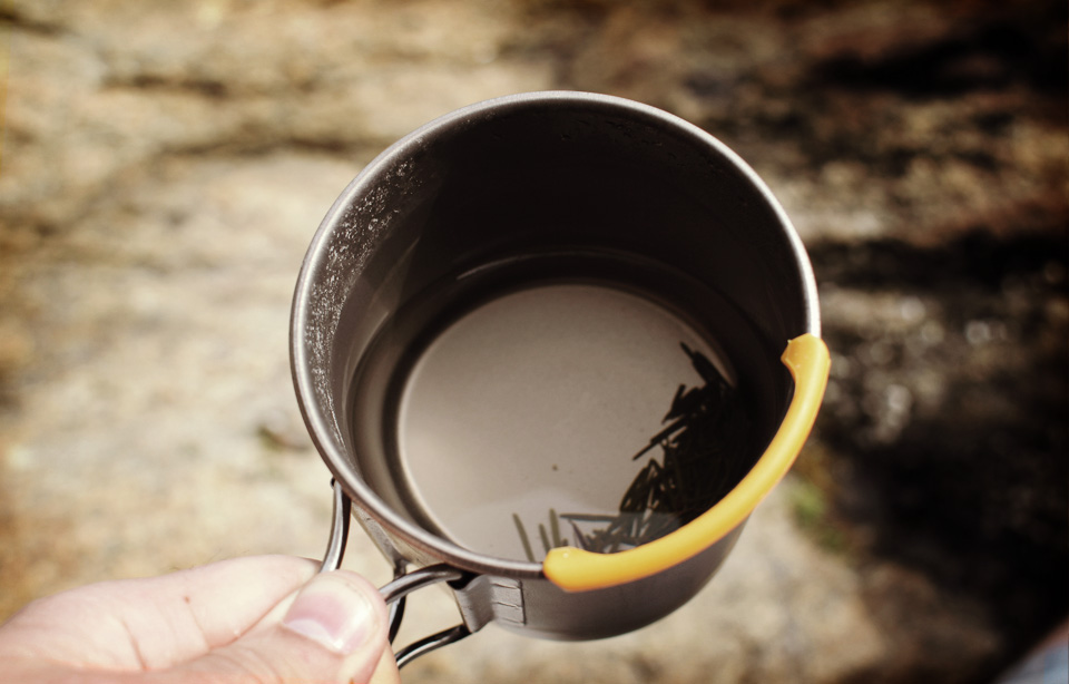
This is my kind of recipe. Hemlock trees are pretty easy to find in Maine. They easliy identifiable with rough grey/red bark. Their needles grow in two neat rows on either side of the branch. The needles have a distinct groove on top and two white stripes on the underside.
I headed to a small wooded trail near Freeport with my soda can stove and came across some young Hemlock trees. I cranked the stove and steeped a palm full of needles for ten minutes and gave it a crack.
The tea was quite pleasant. The taste was subtle, the flavour fragrant and piney. Like walking through a dense pine forest. I'd be happy to have this as an alternate to my regular brew and I'm glad I have experimented with it, if nothing else to increase my tea options when hiking. "The Edible Wild" is such a good book and it's given me a ton more ideas for projects. I already started my dandelion wine, more to come on that soon.
Tips from the Archive #001
Partly inspired by Mike Clelland's excellent Ultralight Backpacking Tips and partly inspired by Aaron Draplin's tweeting philosophy, 'Tips from the Archive' is an open ended compilation of my favorite backpacking tips from hiking history.